Geotechnical and Topography

Collection of geomorphological data, sub-meter georeferencing, and subsurface characterization using LiDAR, GPR, bathymetry, and 3D scanning for the protection of critical infrastructure.

Centimeter-Level Satellite Georeferencing (GPS / GNSS)

Real-time kinematic (RTK) positioning and differential post-processing to establish geometric control networks along extensive transportation corridors.

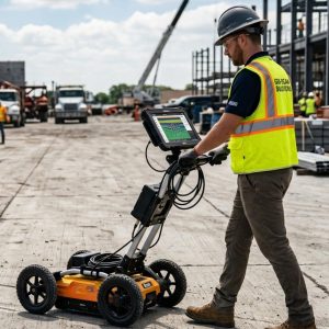
Non-Invasive Subsurface Exploration (GPR Ground Penetrating Radar)

Subsurface electromagnetic mapping to detect buried utilities, voids, and interference before conducting excavations or directional drilling.

High-Resolution Aerial Photogrammetry and LiDAR Imaging

Digital elevation modeling (DEM/DSM) capable of penetrating dense vegetation cover for the assessment of slope stability hazards.

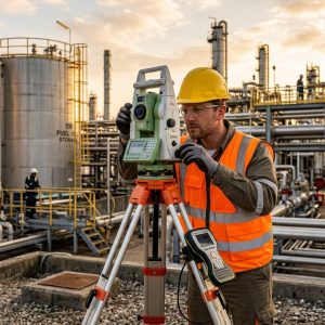
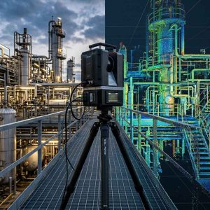
3D Scanning of Land and Assets (3D Scan)

Dense point clouds for deformation analysis of test benches, detailed engineering of existing facilities, and volume calculations for earthworks.

Specialized Services in Geotechnical Engineering, Surveying, and Remote Sensing

Integration of multi-frequency GNSS receivers, digital echo sounders, helicopter-mounted LiDAR systems, and ground-penetrating radar (GPR) to survey the surface and subsurface, ensuring the mapping traceability required by regulatory authorities and asset integrity models.

Certified Experience

More than 25 years of technical experience in Oil & Gas and energy across 6 Latin American countries.

Certificaciones empresa TECNA ICE
Experiencia en Evaluación y Mitigación de interferencias eléctricas en ductos | Tecnaice.
Years of experience in this service
+ 1
Projects executed
+ 1
Km of CIPS inspections
+ 1
Incident-free assessments
+ 1 mill h/m

Our team of cadastral engineers, geologists, and topographers has extensive experience conducting surveys in geographically complex areas in Colombia, ensuring that the technical maps we produce are ready to support critical decision-making in the field.

Frequently Asked Questions

Photogrammetry reconstructs the terrain by superimposing optical images, so dense vegetation blocks the view of the ground. The LiDAR sensor emits active laser pulses that pass through the tree canopy and reflect directly off the natural terrain, making it possible to generate accurate digital elevation models (Bare Earth) in jungles or forests.

The penetration depth depends on the frequency of the antenna used and the electrical conductivity of the soil. High-frequency antennas (800 MHz–1.6 GHz) reach depths of between 0.5 and 1.5 with millimeter-level resolution. Low-frequency antennas (200 MHz–400 MHz) can penetrate up to 3 to 5 meters into dry or silty soils to detect rocks, cavities, and large-diameter pipes.

Bathymetry maps the underwater or subfluvial topography of a body of water. At pipeline crossings, it allows for the measurement of riverbed scouring to verify whether the pipeline has been exposed to the current or if there are risks of sediment transport that could compromise the stability of the crossing.

Georeferenced point clouds are processed into universal formats (LAS, E57, RCP). This data is converted into 3D mesh models, contour lines, or vector elements that can be exported directly to platforms such as AutoCAD, Revit, Civil 3D, and ArcGIS Enterprise, facilitating detailed engineering.

Under optimal satellite visibility conditions, the RTK (Real-Time Kinematic) technique provides accuracies of 1 to 2 cm horizontally and 2 to 3 cm vertically. For higher geodetic requirements, we use post-processed static measurements with extended observation times.

Electromagnetic locators (PCM) are the most efficient tool for locating metal pipes over distances of several kilometers by emitting an active signal. Ground-penetrating radar (GPR) complements this work by detecting non-metallic lines (HDPE, PVC, concrete) and mapping the stratigraphic context around the pipe.

They are governed by the technical specifications of the Agustín Codazzi Geographic Institute (IGAC) for the densification of geodetic networks within the MAGNA-SIRGAS reference frame, as well as by the ANLA’s environmental guidelines for the submission of environmental impact assessments (EIA).

We provide digitized topographic maps (DWG/PDF), classified 3D point cloud files, spatial geodatabases ready for GIS use, geophysical interpretation reports (GPR radargrams), and reports on volume calculations and slope stability.

// Do you need to map the topography or subsoil of your land for your next infrastructure project?

Get personalized guidance.

State-of-the-art equipment, analytical data processing, and an asset integrity approach.

Latest-Generation Sensors

In-house 3D scanning equipment, high-precision GNSS receivers, professional drones, and GPR consoles, all of which are kept up to date with maintenance and calibration.

Geodetic and Legal Traceability

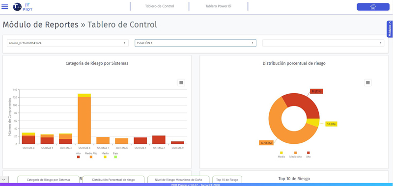
We provide structured geospatial data to feed into pipeline risk models, slope stability calculations, and as-built reconstruction projects.

National Coverage in Complex Geographies

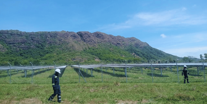
Field crews trained and equipped with safety gear to operate in areas of Colombia that are geographically difficult to access and have harsh environmental conditions.

Direct Integration with Integrity Engineering

We provide structured geospatial data to feed into pipeline risk models, slope stability calculations, and as-built reconstruction projects.


    This form uses Akismet to reduce spam. Learn how your data is processed.

    1