// Technology
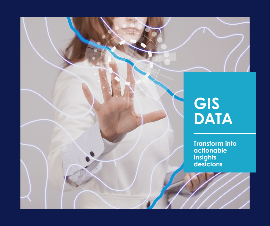
GIS solutions to power operational decisions
At TECNA ICE, we design and implement GIS solutions that enable you to integrate, visualize, and analyze geospatial data in real time.


Scan this QR code to
view TECNA ICE contacts

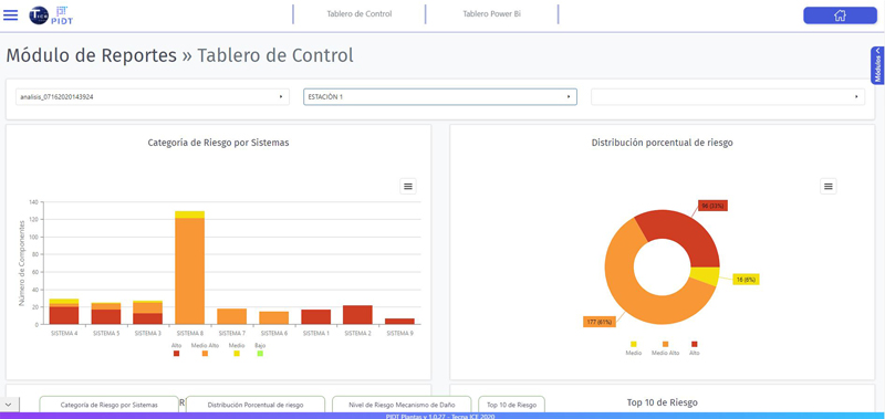
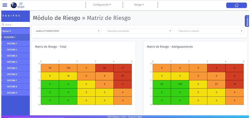
It contains the relevant KPIs to obtain a risk ranking, which are represented by means of dashboards.
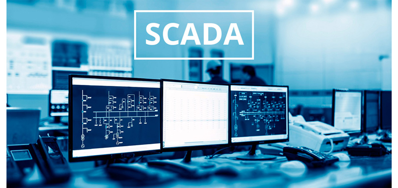
Integrates the PIDT Plants with the SCADA tool, in order to calculate the risk, making use of variables such as pressure,
temperature, flow, etc.
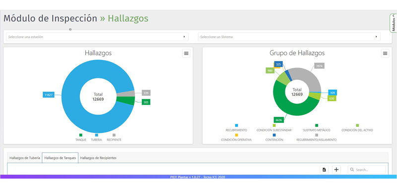
Bulk loading of inspections performed on static equipment, generating an inspection plan derived from RBI and sending SAP alerts.
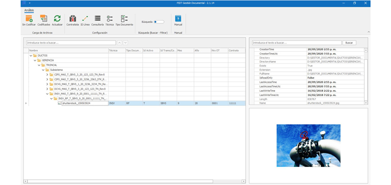
It allows the centralization and codification of the information related to the integrity of the Asset: The necessary nomenclatures are defined in order to identify each document according to its origin. Likewise, each document can be classified in relation to the process in which it is involved. It allows organizing documents by means of a hierarchical tree that enables searches and filters to quickly find documents.
Allows the management, analysis and visualization of information compared to company targets related to:
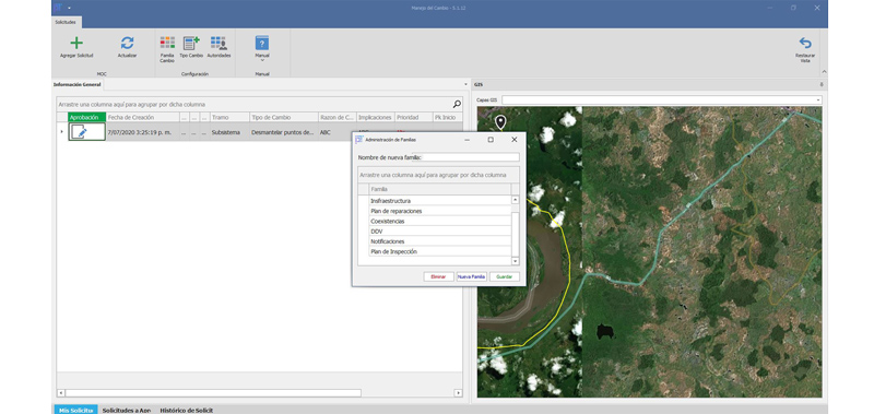
Allows the evaluation and control of modifications to the design of facilities, operation, organization or activities; prior to implementation, in order to ensure that no new elements will be introduced that increase the risk and existing hazards to the business, people or the environment based on applicable regulations.
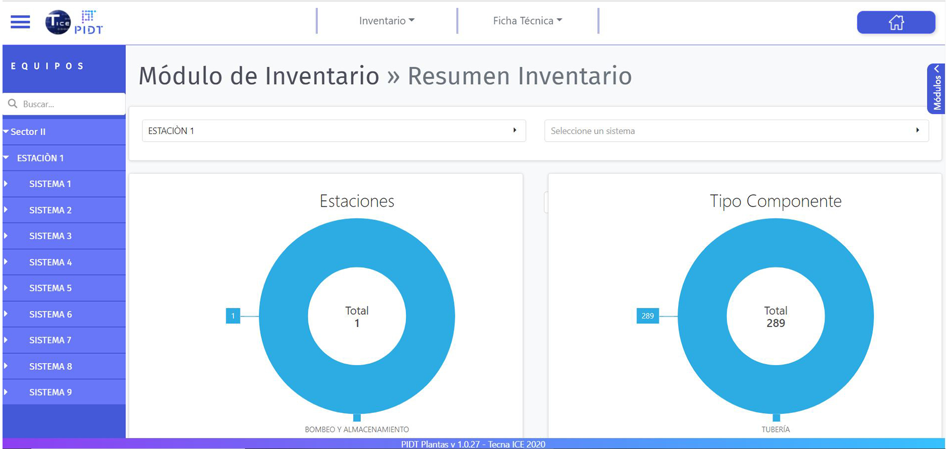
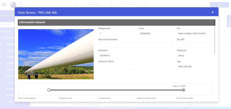
Allows the consultation of information associated with the life cycle of the asset and its accessories.
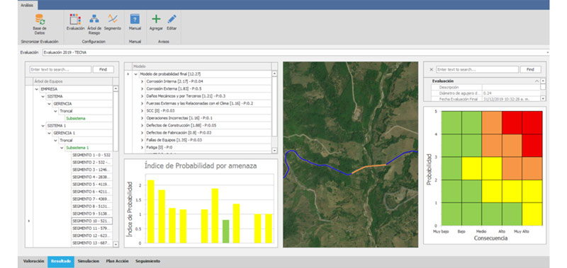
Assesses and analyzes the risk level of the Assets to generate an inspection plan. It is designed to perform the calculation and analysis of static equipment risk under the RP API 581-16 standard. The user will be able to create the required risk assessments
to generate a valuation and inspection plan.
It allows the centralization and codification of the information related to the integrity of the Asset: The necessary nomenclatures are defined in order to identify each document according to its origin. Likewise, each document can be classified in relation to the process in which it is involved. It allows organizing documents by means of a hierarchical tree that enables searches and filters to quickly find documents.